About this resource
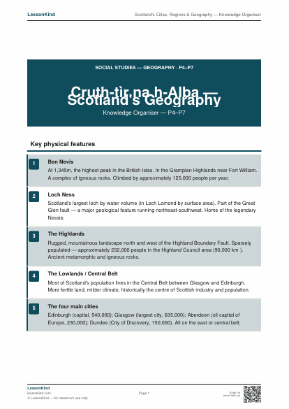
A P4–P7 Social Studies knowledge organiser on Scotland's physical geography — mountains, rivers, lochs, islands — and human geography — the four main cities, Highland and Lowland distinction, and the Central Belt.
What's included
- Print-ready PDF — A4 and US Letter compatible
- No sign-up required — download instantly
- Free to use in your classroom
More like this
More Geography resources

Continents and Oceans
Name and locate the seven continents and five oceans of the world.

World Capitals — Quiz
Match 24 countries to their capitals from across all populated continents.

Major Rivers of the World
The world's eight longest rivers — Nile, Amazon, Yangtze, Mississippi and more — with continent and key fact.

Volcanoes and Earthquakes
Tectonic plates explained — types of volcano, the Richter scale and the Ring of Fire.

World Climate Zones
Tropical, arid, temperate, polar and Mediterranean zones explained, with example locations.

Longitude and Latitude
How the world is mapped using lines of longitude and latitude. Includes coordinate reading practice.
This page contains affiliate links. We may earn a commission at no extra cost to you.
Stay Safe Online with NordVPN
Protect your connection on school networks and at home. NordVPN is trusted by millions — recommended for teachers and students alike.
Get NordVPN →